Travel Guide of Okavango Delta in Botswana by Influencers and Travelers
The Okavango Delta in Botswana is a swampy inland delta formed where the Okavango River reaches a tectonic trough in the central part of the endorheic basin of the Kalahari.
Pictures and Stories of Okavango Delta from Influencers
20 pictures of Okavango Delta from Andreas Berlin, Jonatan Pie, Datingjungle and other travelers
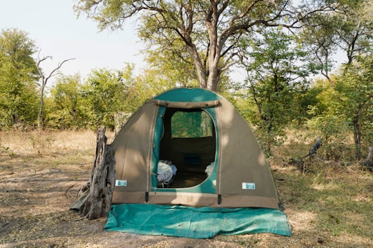
- Camp-out in the forest of Okavango Delta, Bostwana. ...click to read more
- Experienced by @Datingjungle | ©Unsplash
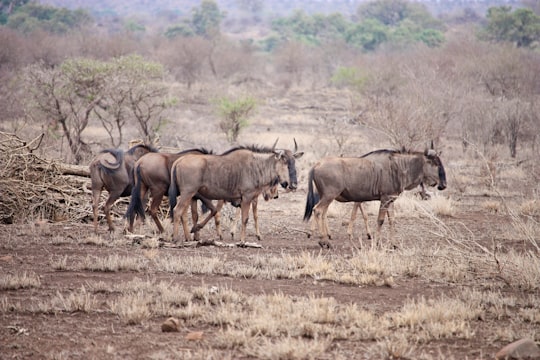
- A family of wildebeests from a self-drive safari through the Okavango Delta in Botswana. ...click to read more
- Experienced by @Amanda Silva | ©Unsplash
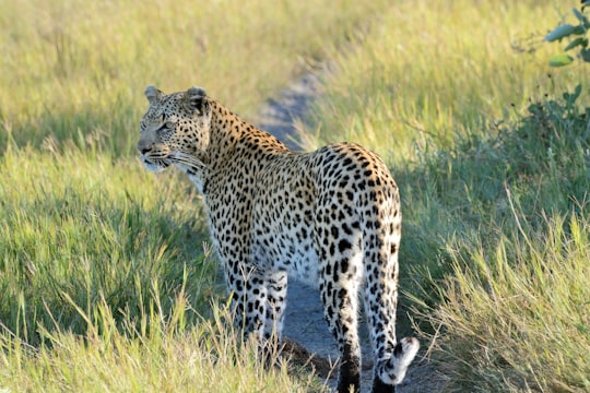
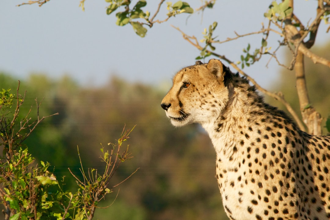
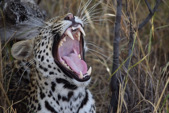
- A leopard hunting in the Okavanga Delta, Botswana ...click to read more
- Experienced by @Colin Watts | ©Unsplash
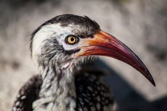
- Zazo aka. Red-billed hornbill ...click to read more
- Experienced by @Eirik Hodne | ©Unsplash
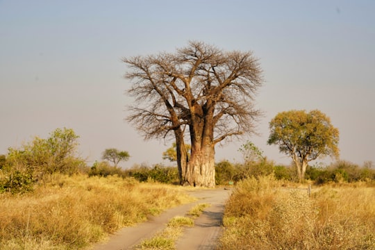
- Amazing tall and old tree in Okavango Delta, Botswana. ...click to read more
- Experienced by @Datingjungle | ©Unsplash
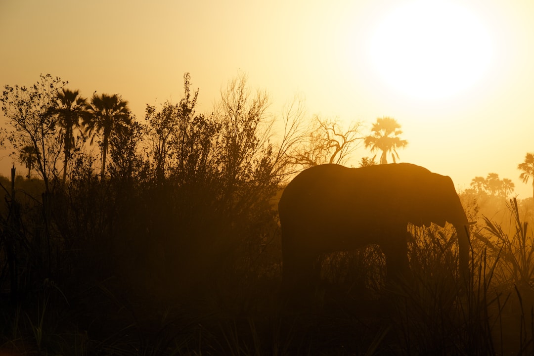
- Beautifully captured moment of an elephant in Okavango Delta, Botswana. ...click to read more
- Experienced by @Datingjungle | ©Unsplash
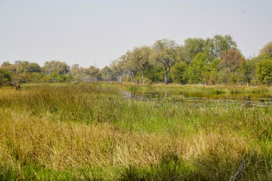
- Awesome nature view in Okavango Delta, Botswana. ...click to read more
- Experienced by @Miriam Eh | ©Unsplash
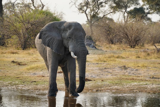
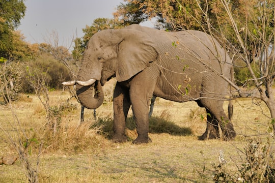
- Mature elephant drinking in the river in Okavango Delta, Botswana. ...click to read more
- Experienced by @Miriam Eh | ©Unsplash
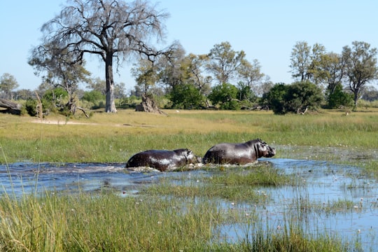
- Hippo crossing water in the Okavango Delta, Botswana ...click to read more
- Experienced by @Colin Watts | ©Unsplash
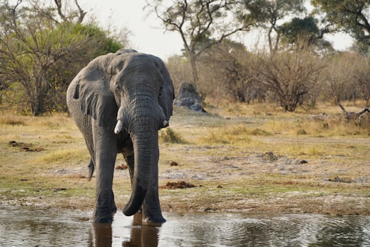
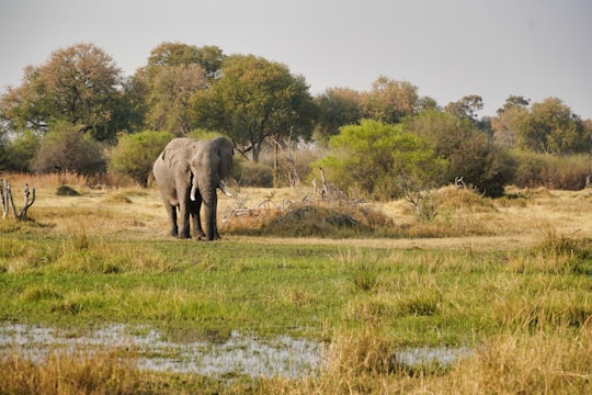
- Amazingly huge elephant in Okavango Delta, Botswana. ...click to read more
- Experienced by @Miriam Eh | ©Unsplash
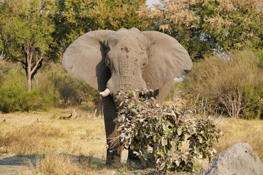
- An elephant enjoying the leafy greens in Okavango Delta, Botswana. ...click to read more
- Experienced by @Miriam Eh | ©Unsplash
- Huge elephant walking gracefully in Okavango Delta, Botswana. ...click to read more
- Experienced by @Datingscout | ©Unsplash
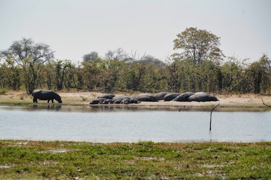
- Witnessing a bunch of hipos in Okavango Delta in Botswana. ...click to read more
- Experienced by @Miriam Eh | ©Unsplash
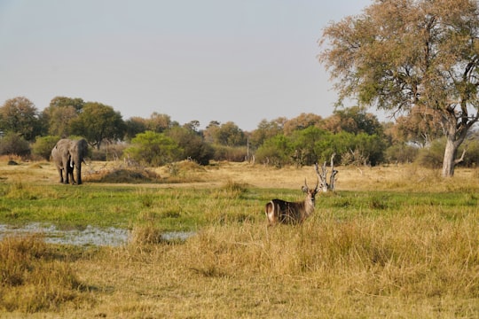
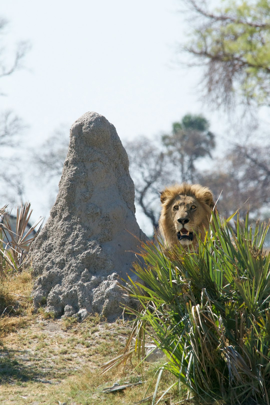
- Animals in the wild in Okavango Delta, Botswana. ...click to read more
- Experienced by @Miriam Eh | ©Unsplash
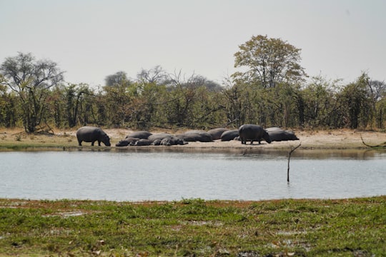
- Hippos resting in Okavango Delta, Botswana. ...click to read more
- Experienced by @Datingjungle | ©Unsplash
Plan your trip in Okavango Delta with AI 🤖 🗺
Roadtrips.ai is a AI powered trip planner that you can use to generate a customized trip itinerary for any destination in Botswana in just one clickJust write your activities preferences, budget and number of days travelling and our artificial intelligence will do the rest for you
👉 Use the AI Trip Planner
Book your Travel Experience at Okavango Delta
Discover the best tours and activities around Okavango Delta, Botswana and book your travel experience today with our booking partners
Map of Okavango Delta
View Okavango Delta on a map with the closest popular places nearby
More Travel spots to explore around Okavango Delta
Click on the pictures to learn more about the places and to get directions
Discover more travel spots to explore around Okavango Delta
Natural landscape spots 🌲 Ecoregion spots 🌲 Plain spots 🏞️ Watercourse spots 🏞️ Lake spots 🐾 Wildlife spots 🏕️ Camping spots Body of water spotsLearn More about Okavango Delta
The Okavango Delta (or Okavango Swamp) is the second largest inland delta in the world (18,000 km2) after the central Niger Delta. Located in northern Botswana, the Okavango has no sea mouth and flows into the Kalahari Desert, irrigating 15,000 km2 of desert. Several million islands have formed around the termite mounds or clumps of vegetation that hold the alluvium.
Where to Stay near Okavango Delta
Discover the best hotels around Okavango Delta, Botswana and book your stay today with our booking partner booking.com
Popular destinations near Okavango Delta
Disover the best Instagram Spots around Okavango Delta here
Ngamiland East
48 km (29.7 miles) away from Okavango Delta
Ngamiland East is one of the subdistricts of Ngamiland District of Botswana.
Travel guide of Ngamiland East